Learn the basics of GIS in ArcGIS software, then perform watershed delineation in ArcGIS Pro
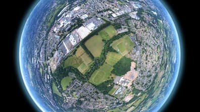
In our course, you will learn to use the basic GIS tools inside ArcGIS, which is the leading GIS software.
If you are looking for a great introductory course, then look no further!
Together with our teacher, Sam, we are here to guide you, and offer suppression to any questions or curiosities you may have!
The course will constantly grow in the number of videos and curriculum, so you may feel overwhelmed! Please do not hesitate to contact us whenever you feel you need further information!
Finally, some great resources are ArcGIS online documentation, available on the ESRI website.
According to Wikipedia, A geographic information system (GIS) is a type of database containing geographic data (that is, descriptions of phenomena for which location is relevant), combined with software tools for managing, analyzing, and visualizing those data. In a broader sense, one may consider such a system to also include human users and support staff, procedures and workflows, the body of knowledge of relevant concepts and methods, and institutional organizations. Information systems.
In this course you will learn everything you need to learn about the essential ArcGIS tools, basic GIS concepts, understanding GIS data, adding data to a map, symbolizing the data, and creating the map layout! The second part of the course will introduce you to ArcGIS Pro, the wonderful world of hydrology, remote sensing, and land cover. Will teach you how to display a watershed delineation, create the map in ArcGIS Pro and also create a map story in ArcGIS Online.

Map making professional with over 6 years of experience. I have worked for small and large companies in various fields, from housing agency to GPS manufacturer looking to develop super apps. I love to share my experience and knowledge with other professionals interested to develop their skill. I constantly try to differentiate myself and the courses I help develop and to make sure the students gets the best content both in audio-video presentation and the correct rate of theory to practice within my courses. I have studied map making at the bachelor level and geomatics at master level, at the University of Babes-Bolyai, Cluj-Napoca, Romania. I am open to communication and suggestions for further development.
This portal is provided as a training and development resource for City of Markham employees. Every course is delivered by a qualified subject matter expert or learning organization, is quantifiable in hours, and is verifiable — you receive a documented certificate of completion for every course you finish, stored on LearnFormula indefinitely.
If you hold a professional designation (for example in engineering, accounting, human resources, or law), courses may be counted as professionally relevant, verifiable learning activities toward your continuing professional development. Individual practitioners are responsible for confirming that an activity meets the requirements of their professional body. For questions about the City of Markham's training and development policies, please speak with your people leader or Human Resources.
